
Mahoning County Tax Map & GIS Guide: View Parcel Boundaries Online
Finding a Mahoning County Tax Map or viewing parcel boundaries is now easier than ever with the 2026 GIS system.The […]
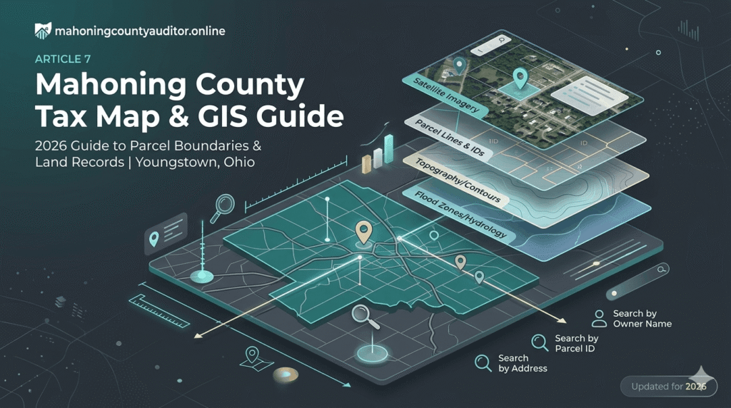
Explore interactive geographic information systems to view parcel boundaries, zoning layers, and aerial imagery. Our platform provides easy access to local mapping data, helping you visually analyze property lines and neighborhood layouts.
Finding a Mahoning County Tax Map or viewing parcel boundaries is now easier than ever with the 2026 GIS system.The […]